

The six-step
framework designed
to improve the quality
and consistency of GIS
data submissions
for BNG assessments.
In January 2025 we published our whitepaper
Addressing GIS Data Standards in
Biodiversity Net Gain Management.
We recorded some of the problems currently
faced by local planners and BNG operatives.
For example: ~25% of LPA-accepted
assessments contain errors regarding
aggregation of habitat areas between
the baseline and post-development scenarios.
We reviewed several aspects of data quality
to inform a new BNG based GIS data standard.
From this we have developed a checklist solution that improves
GIS data to support BNG assessments for planning applications.


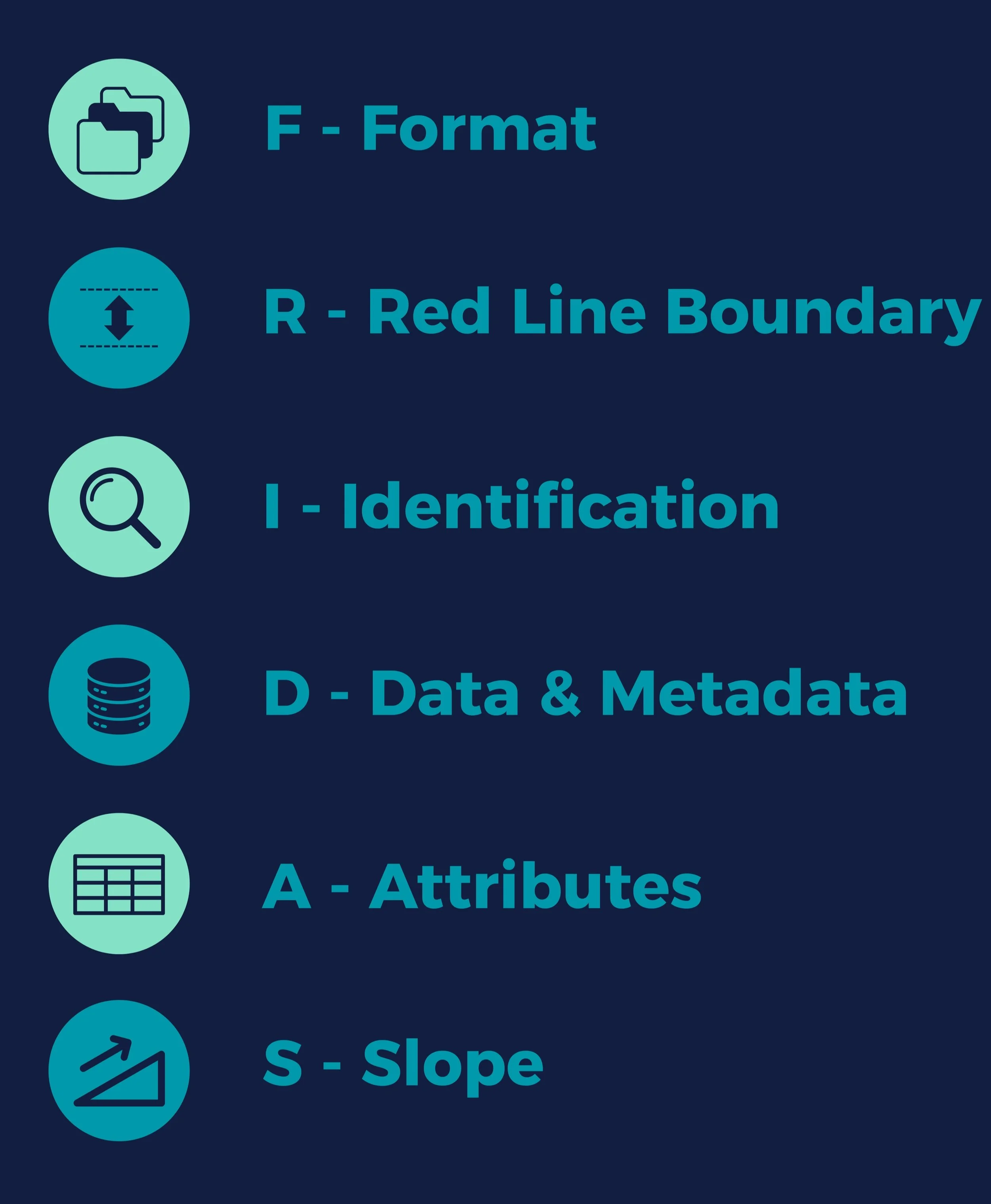
stands for
By addressing these six categories, FRIDAS ensures that
submitted data is robust, traceable, and
adaptable to evolving policy requirements.
Each FRIDAS category is supported by targeted
questions to guide users through the data validation process.