
Analysing Baseline Land Ownership

The Vision
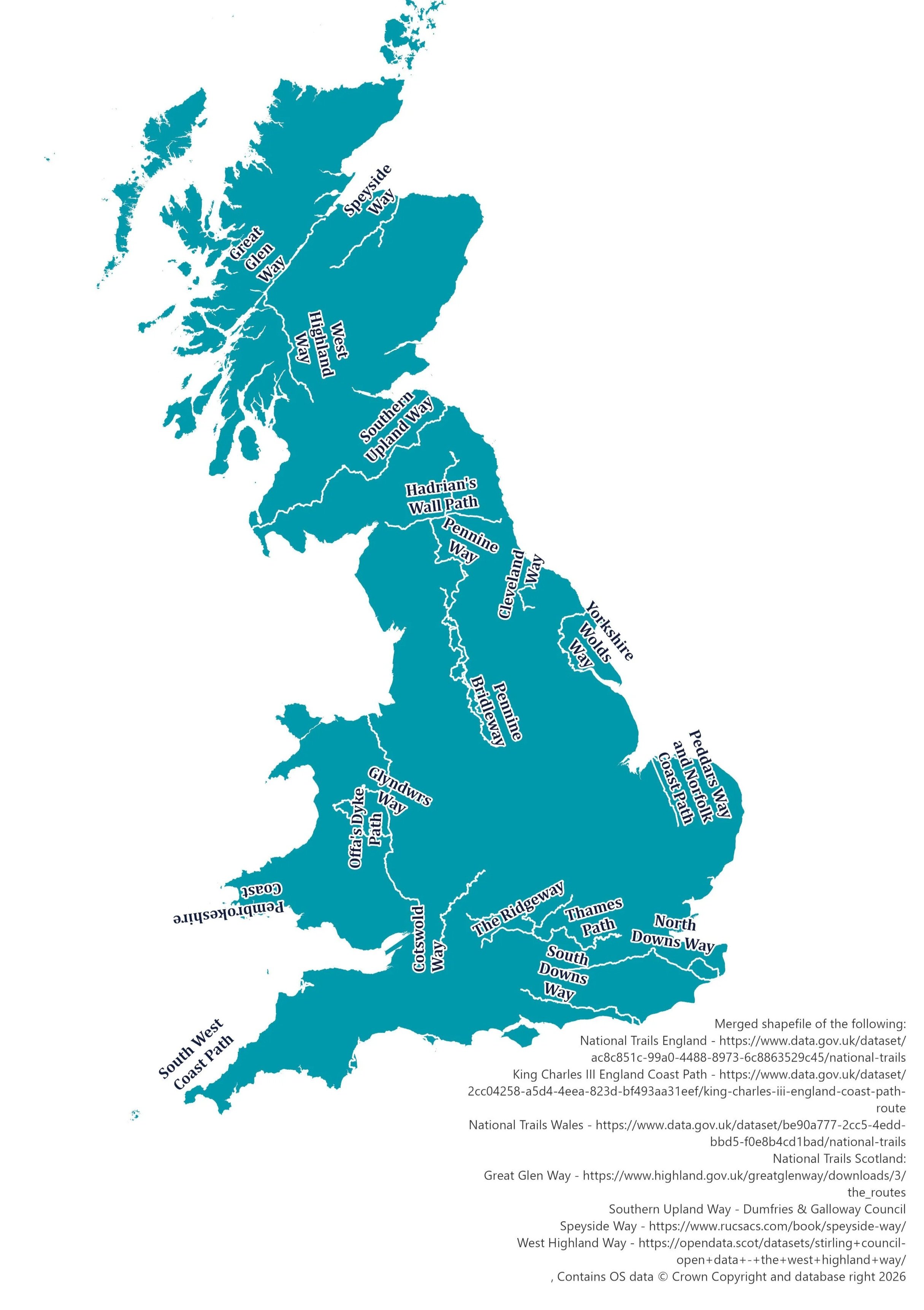
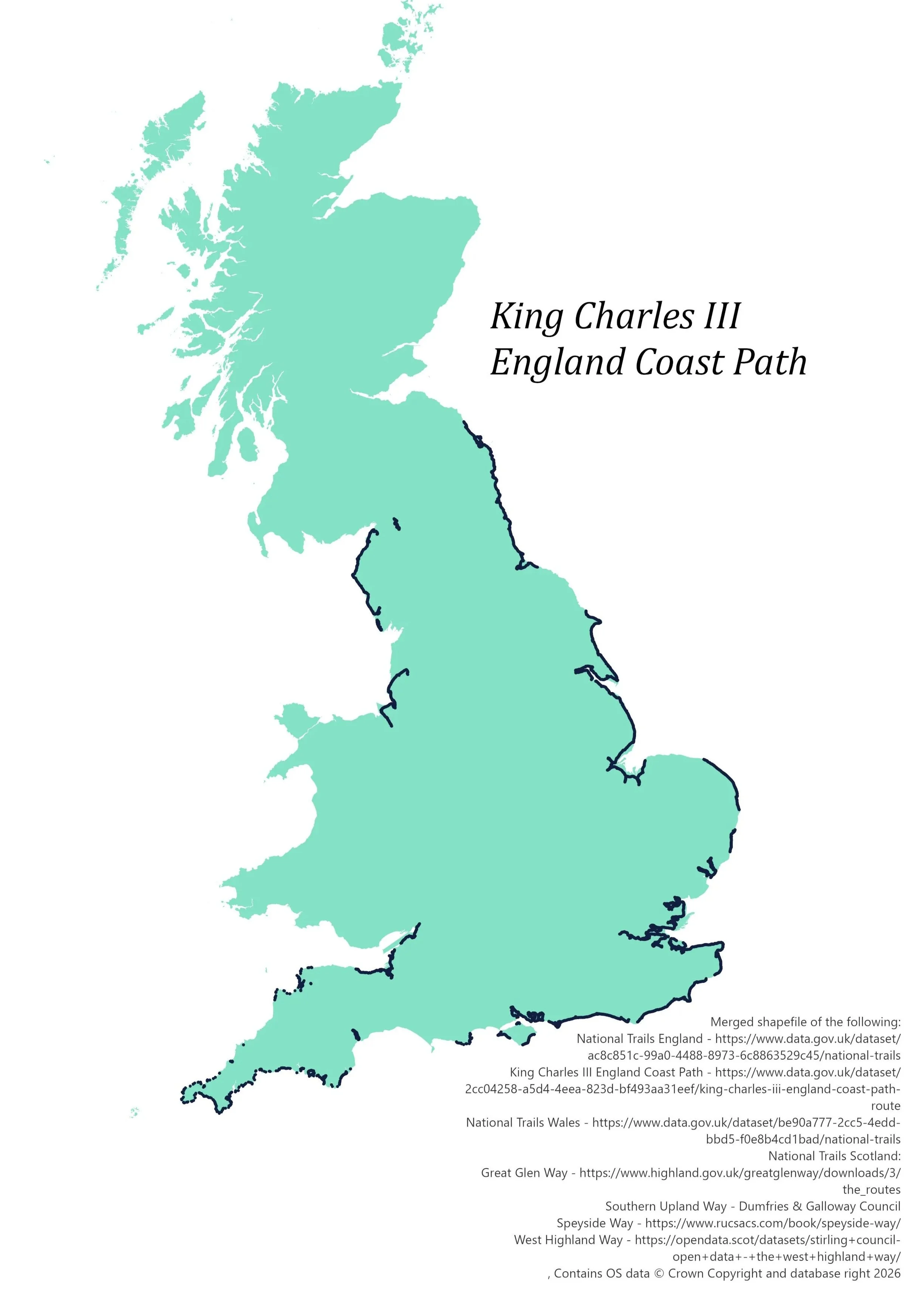
National Trails UK sought to establish a clear, consistent understanding of landownership across the UK’s National Trails network, including the King Charles III England Coast Path and associated coastal margin.
The aim was to create a single, reliable evidence base that would support nature recovery, improve access planning, and enable more effective engagement with landowners and partners across these nationally significant landscapes. A key requirement was that the outputs could be used at multiple scales, from individual trails to regional and national summaries, while remaining accessible to both GIS and non‑GIS users.
Challenge
National Trails UK did not have a single, consolidated view of who owns land along the trail network or coastal margin. Landownership data is complex, fragmented, and often inconsistent, particularly across different geographies and ownership types.
The key challenges included:
Integrating national landownership parcel data with linear trail and coastal datasets
Producing consistent outputs across multiple spatial scales (trail, region, and country)
Handling incomplete ownership attribution, including private and non‑registered land
Delivering outputs that are both technically robust and usable by non‑GIS stakeholdersApproach
EcoSpatial designed and implemented a structured
GIS Approach
EcoSpatial designed and implemented a structured GIS workflow in ArcGIS Pro to associate landownership parcels from the LANDCLAN dataset with National Trails, the King Charles III England Coast Path, and the coastal margin.
Key steps included:
Spatially assigning parcels to individual trails, coastal regions, and countries
Calculating both full parcel areas and the proportion of land falling within defined corridors (100m buffers) and coastal margins
Clipping parcel geometries to create accurate “in‑corridor” representations
Aggregating data to produce ownership summaries and rankings
Excel Approach
Additional processing in Excel was used to:
Separate residential land from broader “No ownership information” categories
Derive consistent ownership classifications
Calculate percentages and final reporting metrics
Outputs
The project delivered a comprehensive and reusable landownership dataset, including:
A structured PDF report presenting:
Ownership summaries by trail, region, and country
Identification of the largest landowners across the network
Detailed summary tables supporting further analysis
Ranked lists of the top 100 landowners for each analysis unit
ArcGIS Online datasets enabling interactive exploration of ownership patterns
Spatial data (shapefiles) including:
Full parcel geometries
Clipped parcel datasets representing land within buffers and coastal margins
Benefits
· Enables a clear view of who owns land along trails and coastal routes, making it easier to identify key landowners and organisations for engagement.P
· Provides a consistent national dataset that can be used to underpin funding bids, strategic planning and programme delivery.
· Helps focus engagement efforts by highlighting areas where land ownership is concentrated or where key stakeholders are present.
· Can be reused and updated over time, or applied to other programmes and geographies as requirements evolve.
· Can be accessed in a range of formats, including reports, tables and interactive GIS datasets, making it usable for both technical and non-technical audiences.
· Clearly shows where ownership information is known and where it is not, allowing for more realistic planning and expectations around engagement and delivery.
This work was made possible thanks to funding from Defra via the Protected Landscapes Partnership.